Into the Siberian wilderness
Birobidzhan to Ulan Ude
This section covers the 2,711 kilometers section from Birobidzhan to Ulan Ude. It took approximately two days, passing mostly through coniferous forest (taiga) with the largest city being Chita, population 325,000, at km 6198 (from Moscow).
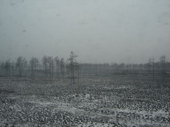
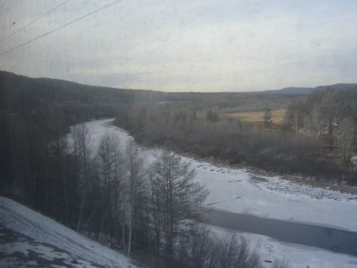
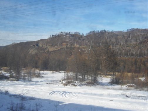
Leaving Birobidzhan, 8351 km, the scenery which so far had been rural with villages and small towns, changed to taiga with dense stands of paper birch. The area was essentially uninhabited with open areas not tended in any way. The railway followed the course of small rivers and we soon realised that in fact we were climbing as the curving was incessant and the same view of the river below could be seen from different angles as we progressed. Looking on Google Earth it is clear that the terrain is actually very hilly but the dense taiga blocked clear vistas.
Life on board settled into a routine with stops every two or three hours and longer stops after eight to twelve hours. At each principal station, small, portable locked steel cages of coal were noted. These were for the train heating systems, each car having its own stove, which also provided the hot water for the samovar, which supplied a welcome and endless supply of tea.
We also discovered that at the longer stops the locomotive was exchanged, just why it was felt necessary to replace one electric locomotive with an identical one was unclear, but as the replacement locomotive often had a different livery perhaps each operating division kept its own locomotives. Whatever the reason it hardly seemed efficient.
One thing that I discovered by accident was that the attendants locked the toilets about ten minutes before each stop and unlocked them about ten minutes after we resumed moving, it was explained it
was to stop un-ticketed passengers trying to hitch a ride. As a consequence, one had to check the schedule before using the toilet for an extended period and be aware when the toilet would be off limits.
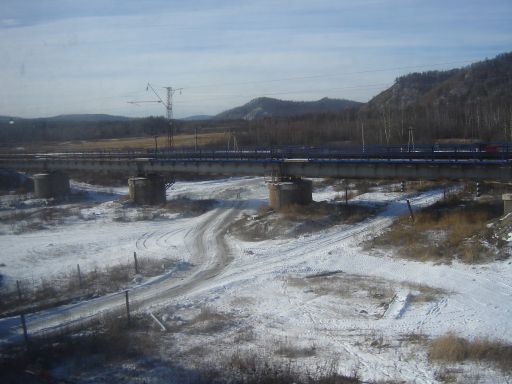
The railway remained double track and was fully electrified; we passed a succession of trains heading east mostly freight. There were frequent stations, and while the larger ones were named the smaller ones were simply using the kilometre distance to Moscow. The commercial consideration of providing stations with little prospect of passengers clearly was not important.
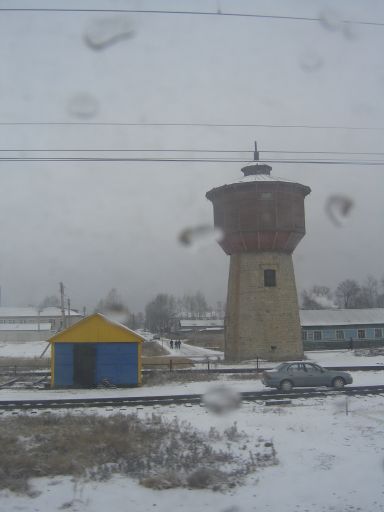
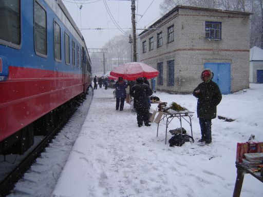
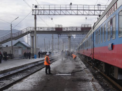
After about three hours we arrived at our first longer scheduled stop on this section, the town of Obluche (8190 km). As at Kharbarovsk people got off to walk and stretch. All along the platform local people had set up stalls selling food and drink. They seemed to do a good trade and this was repeated at most stops as we crossed Siberia.
Leaving Obluche the railway heads northwards again and the Amur River, which forms the border with China, closely parallels the railway to the south, as evidenced by guards at bridges. The Trans Siberian Road also follows the railway in this area, but the towns were sparse and most of the time the endless taiga forests were all that kept us company. At Amazar (7004 km) the Amur River, and the border, turns south, becoming the Argun River. It appeared that when the line was double tracked, the opportunity was taken to engineer a totally new alignment in some locations (as evidenced by the abandoned grade winding beside us). In other places there were separate bridges and approach embankments, this was probably done to avoid disturbing the foundations of the existing single track bridge.
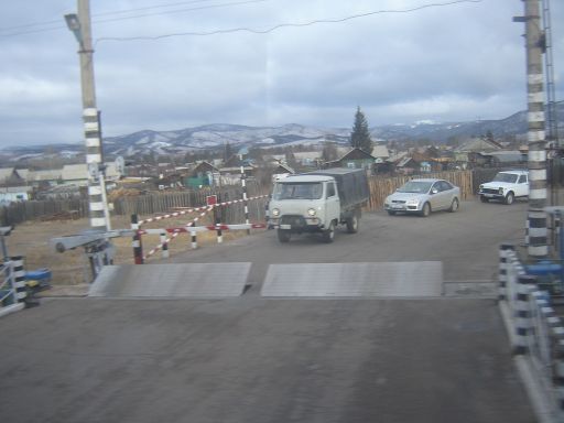
At times we would stand in the corridor to change the side we were viewing. I can understand that for regular passengers there was little of interest to see (I have heard similar comments on VIA’s Canadian both in Ontario and out on the prairies), however for railway buffs there were things to note. For example, at grade crossings there was usually a manned guard hut, which controlled the gates and something I had never seen before, steel flaps that when activated were raised in the roadway to present a serious obstacle to any road vehicle that failed to obey the crossing lights.
As we headed west the weather became poor with long periods of snow, which soon caused the windows to become dirty. This made photography difficult and unfortunately cleaning the windows was impossible from the ground level platforms.
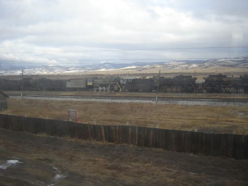
After thousands of kilometres of wilderness, we encountered something of a surprise: large industrial ruins at Petrovsky Zavod (5784 km). This had been the site of an iron works since the 18th Century, but the works are currently derelict, probably not unexpected given the remote location.
Since departing Vladivostock, we had been served three meals a day served in our compartment, this was part of the full meal service, but as this portion of the journey progressed, we began to wonder if this had been a wise choice. While the food was well prepared and served hot the choice decreased incrementally so that by the time Ulan Ude was reached, there was no choice at all. It made the fresh food on the station platforms look inviting, and we did resort to purchasing juice from a station kiosk at one of the stops.
As we approached Ulan Ude, we entered a wide valley with farms and villages, so we knew that our passage through this section of the Siberian wilderness was nearly over. While this part of the article concludes at Ulan Ude, just fifteen kilometers east of there is Zaudinsky Station (5655 km), which is the junction for the Trans-Siberian route through Mongolia to Beijing, China. Our train did not stop there because Ulan Ude is the principal station for passenger interchange. Ulan Ude to Irkutsk including the scenic stretch along Lake Baikal will be the subject of the next article.